Aydın,
-4°C
açık
Scientists have developed a new modeling approach that looks ahead to where roads are likely to be built in the world’s largest tropical forests. By forecasting the expansion of so‑called ghost roads—unofficial, often illegal tracks that open up remote forest areas—they can pinpoint hotspots that are most vulnerable to rapid deforestation in the Amazon, Southeast Asia and sub‑Saharan Africa.
The research team combined satellite imagery, historical road‑construction data, and socioeconomic variables such as logging permits, mining concessions and population pressure. Using machine‑learning algorithms, they generated probability maps that highlight where new roads are most likely to appear over the next decade.
Key factors that drive road emergence include:
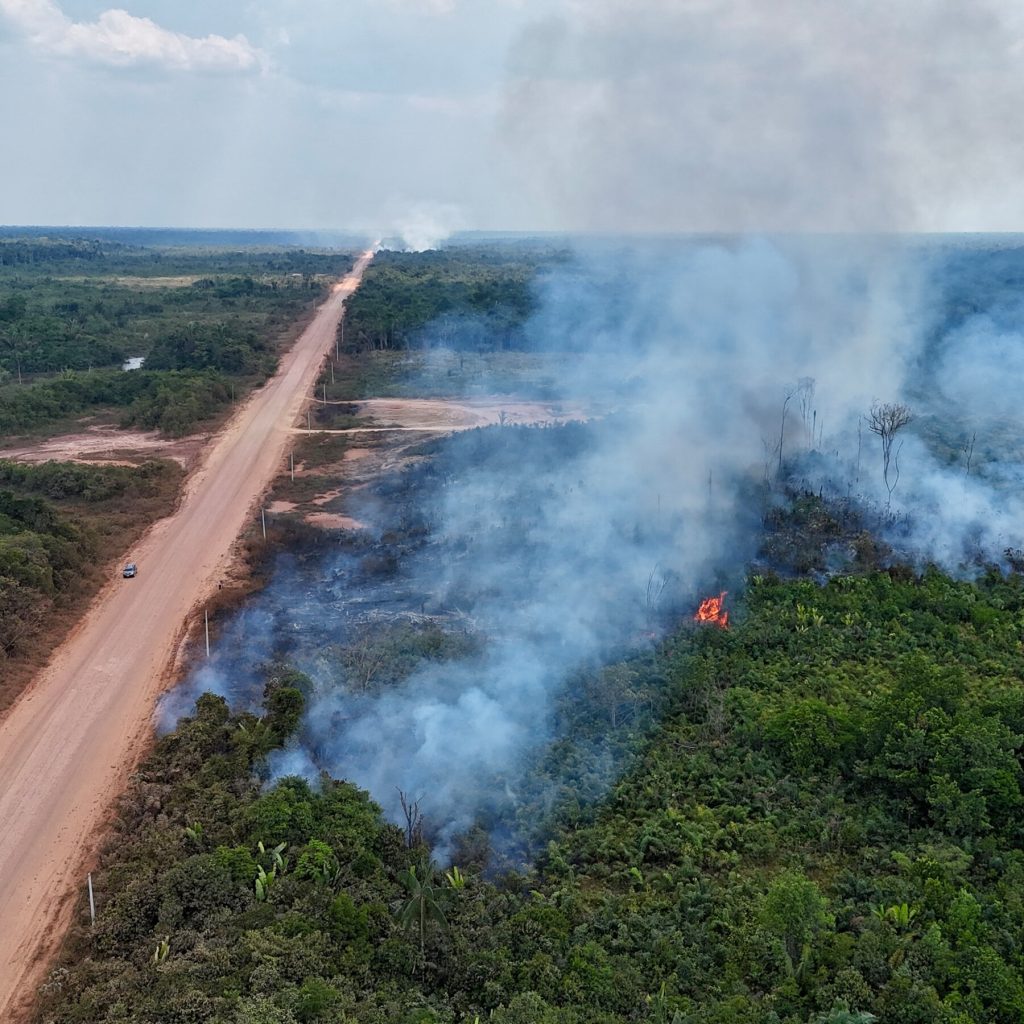
In the Amazon basin, the model identified a cluster of high‑risk zones along the western edge of Brazil and eastern Peru, where illegal logging companies have already begun clearing pathways. In Southeast Asia, the focus shifted to the Indonesian province of Kalimantan, where palm‑oil expansion and mining are driving a surge of makeshift tracks. Meanwhile, in Africa, the Congo Basin’s northern fringe emerged as a critical area, with recent gold‑rush activities spawning a network of hidden trails.
Even before a single tree is felled, a road can act as a catalyst for forest loss. It provides access for loggers, hunters, and settlers, fragments habitats, and opens the door to invasive species. Moreover, these roads often remain invisible on official maps, making enforcement nearly impossible.
Based on the predictive maps, the authors propose a three‑pronged strategy:
By targeting the root cause—the creation of access routes—rather than reacting to deforestation after it occurs, governments and NGOs can safeguard millions of hectares of pristine forest.
The researchers stress that their model is a living tool; it will improve as more data become available and as on‑the‑ground verification refines the predictions. If adopted widely, this proactive approach could become a cornerstone of global forest‑conservation strategies, turning the tide against the silent, creeping threat of ghost roads.